The City of London with every building removed
Environment Agency LiDAR shows the land under the Square Mile: Ludgate Hill, Cornhill, the lost Walbrook and the Fleet valley, plus a walk to feel it.
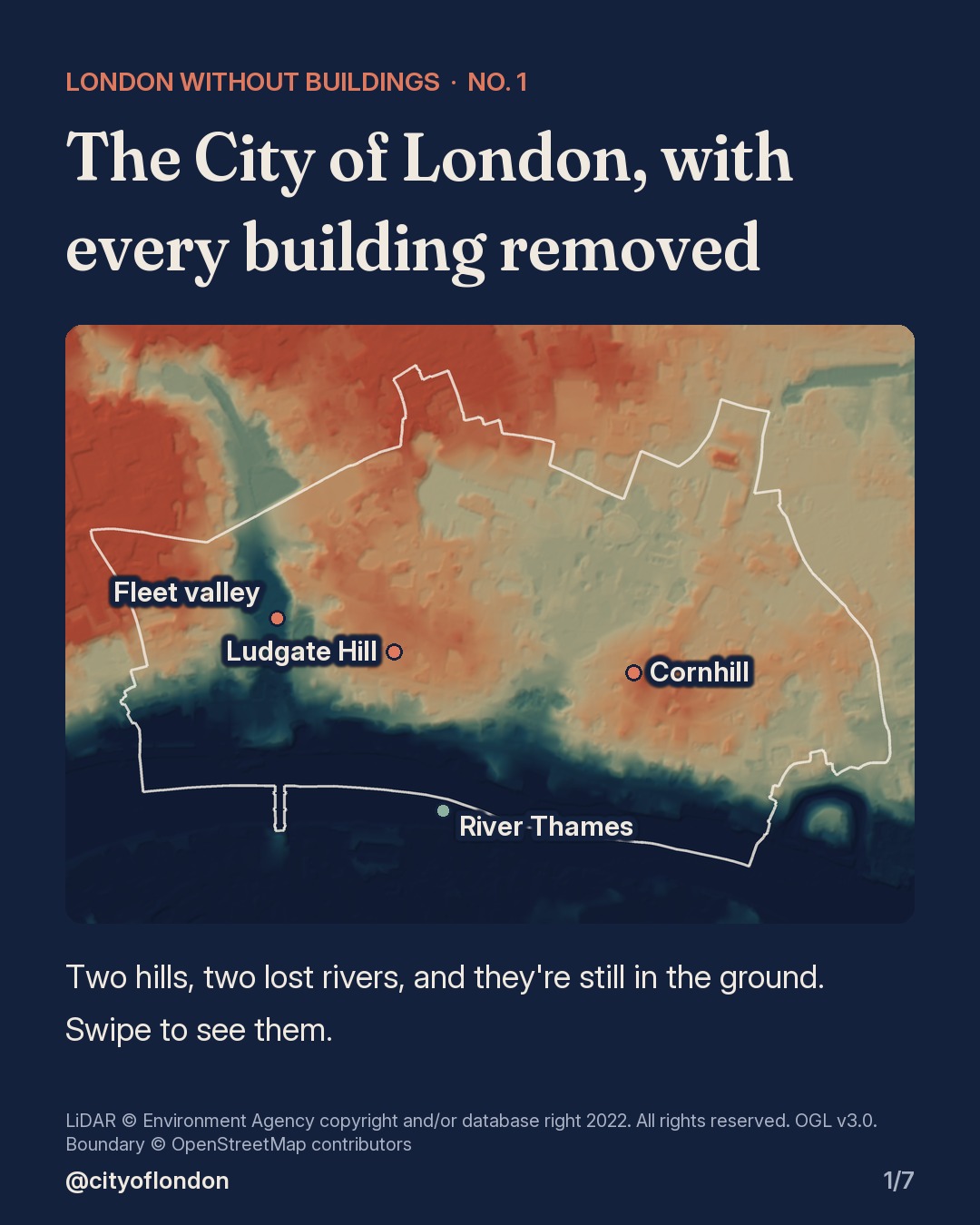
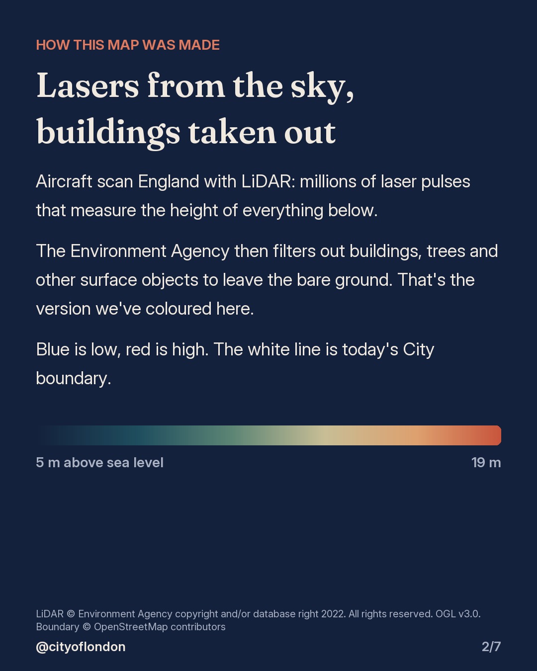
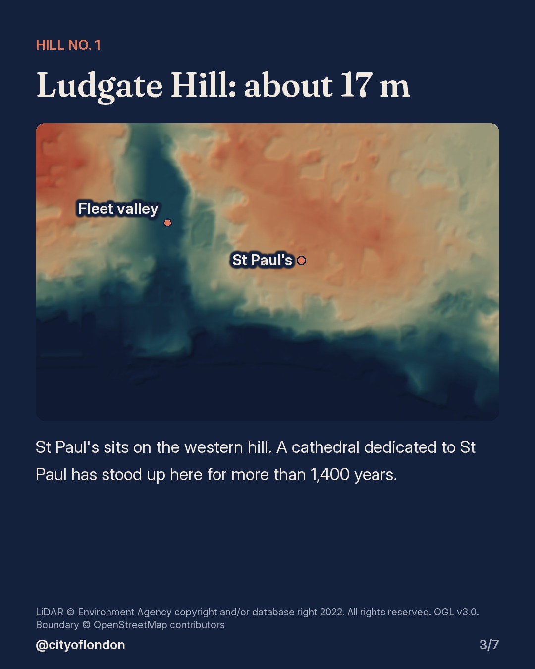
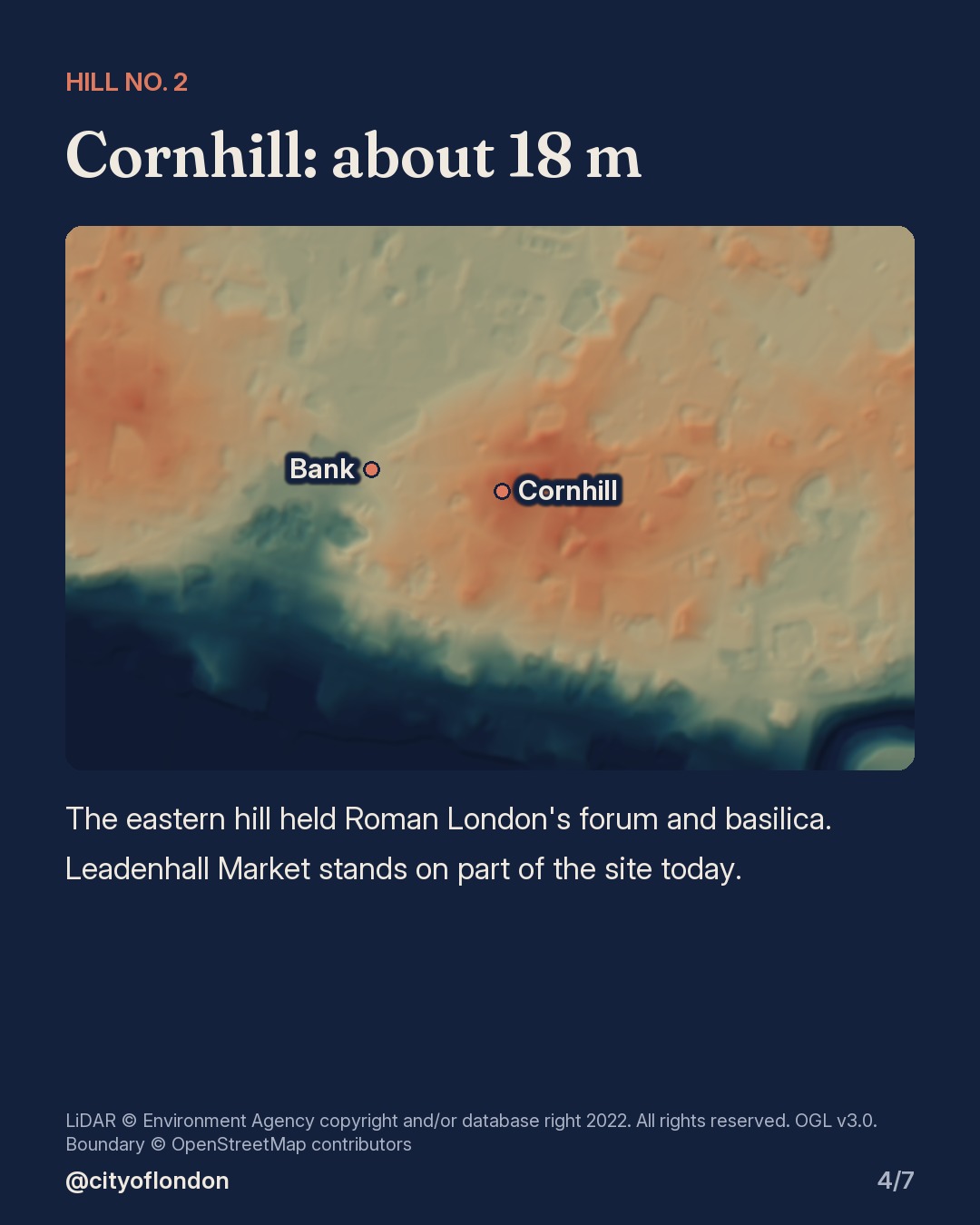
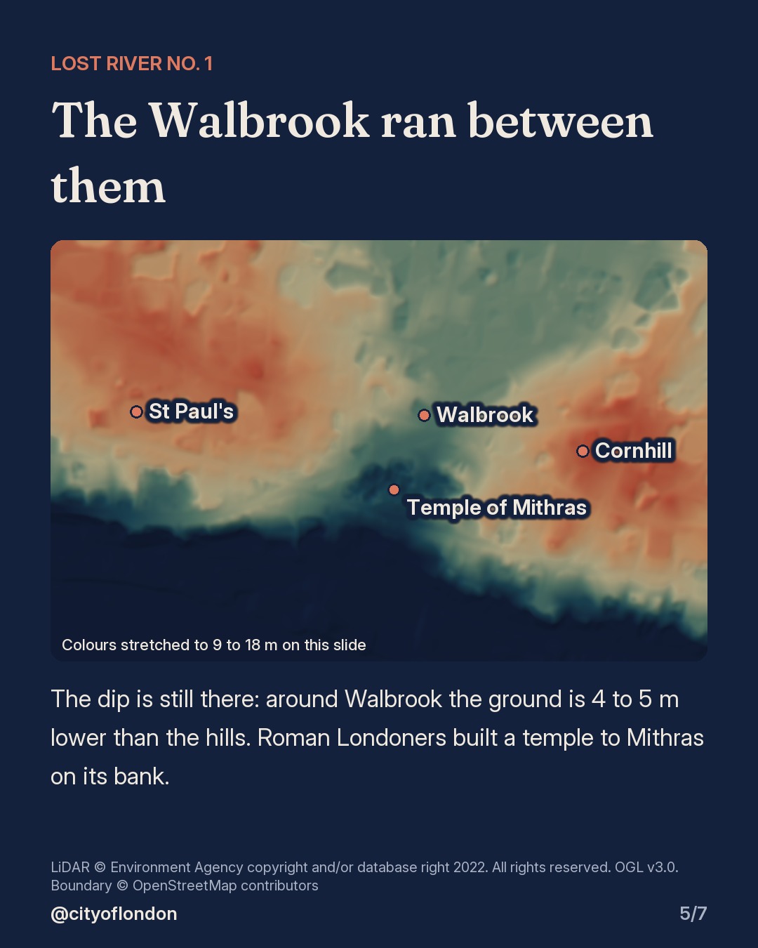
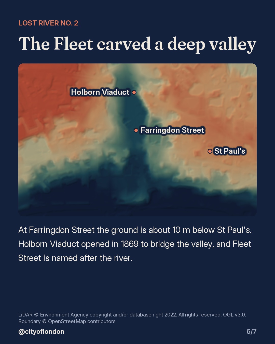
Strip away the towers and you can still see the shape of the land the Romans chose: two low hills with a stream between them, and a deep river valley to the west.
📍 Ludgate Hill: about 17 m above sea level, with St Paul's on top
📍 Cornhill: about 18 m, where Roman London's forum and basilica stood
💧 The Walbrook: the lost stream between the hills. The ground around Walbrook is still 4 to 5 m lower than the hills.
💧 The Fleet: at Farringdon Street the ground is about 10 m below St Paul's
Walk it: start at St Paul's, head east along Cheapside and feel the slope down to Bank, then climb Cornhill.
Heights are our own readings of the Environment Agency's 1 m LiDAR terrain model (buildings filtered out), smoothed to show the shape of the land. LiDAR: © Environment Agency copyright and/or database right 2022. All rights reserved. Open Government Licence v3.0. Boundary: © OpenStreetMap contributors.
Send this to someone who walks past St Paul's every day.
Slide by slide.
Sources (10)
- https://www.british-history.ac.uk/rchme/london/vol3/pp10-18
- https://www.cityoflondon.gov.uk/assets/Things-to-do/roads-to-rome-self-guided-walk.pdf
- https://www.stpauls.co.uk/our-timeline
- https://www.stpauls.co.uk/about-us
- https://leadenhallmarket.co.uk/history-of-leadenhall-market/
- https://historicengland.org.uk/listing/the-list/list-entry/1391846
- https://www.british-history.ac.uk/old-new-london/vol1/pp32-53
- https://www.londonmuseum.org.uk/collections/london-stories/holborn-viaduct-the-citys-bright-red-bridge/
- https://historicengland.org.uk/listing/the-list/list-entry/1064641
- https://environment.data.gov.uk/dataset/13787b9a-26a4-4775-8523-806d13af58fc